LA FloodMaps - Base Flood Elevation Scenarios - Help
Some information you need to fill in the boxes on the Base Flood Elevation Scenarios tool is included in the point data associated with your pins. You can find it in the Points tool and in the data table on the Print-Preview page.
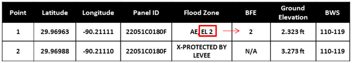
- For Flood Zones "X", "X-PROTECTED BY LEVEE", or "0.2% Annual Chance", there is no BFE.
- For Flood Zones "AE, EL #" and "VE, EL #" the BFE is the # shown in the zone designation.
- For Flood Zones "AO (Depth = #)", the practical equivalent of BFE is the ground elevation plus the "#".
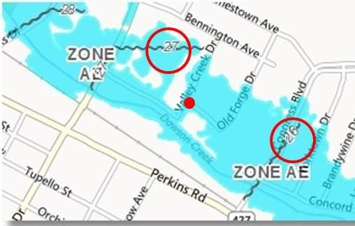
For Flood Zones "AE" and "VE", BFE’s are often shown at discrete points within the zones, denoted in whole numbers by wavy lines running across the floodplain.
The BFE can be estimated as the higher or lower number on wavy lines near your point, or calculated in tens of a foot by interpolation. For example (shown left): If a point is slightly nearer the BFE line labeled 27 than to the one labeled 26, the BFE at that point would be about 26.6)